SAME CITY

SAME CITY is a dynamic urban design project led by LINKLAB that explores how the predominance of sameness impacts Phoenix's residents and the policies that sustain it. This research analyzes geospatial data relative to Phoenix’s growth between 1940 and 2020 to explore critical questions such as: How does sameness affect our health? What does it reveal about community dynamics? And how can we transform this knowledge to foster wellbeing, multicultural representation, and equity?
So how did Phoenix become a city of repetitive streetscapes? To answer this question, we must go back to the 1930s. The New Deal Housing Act offered federal loans to middle-class white Americans who chose suburban life.
In the 40’s, World War II brought many veterans and their families to the valley.
In the 1950s and 1960s, middle-class Americans in the Midwest and Northwest were looking for a place to escape from their poor city life. The signs of the rise of car ownership, shopping centers, and mass-produced homes were a looming migration boom.

The Grid As a Tool
[1] Alignment & Growth
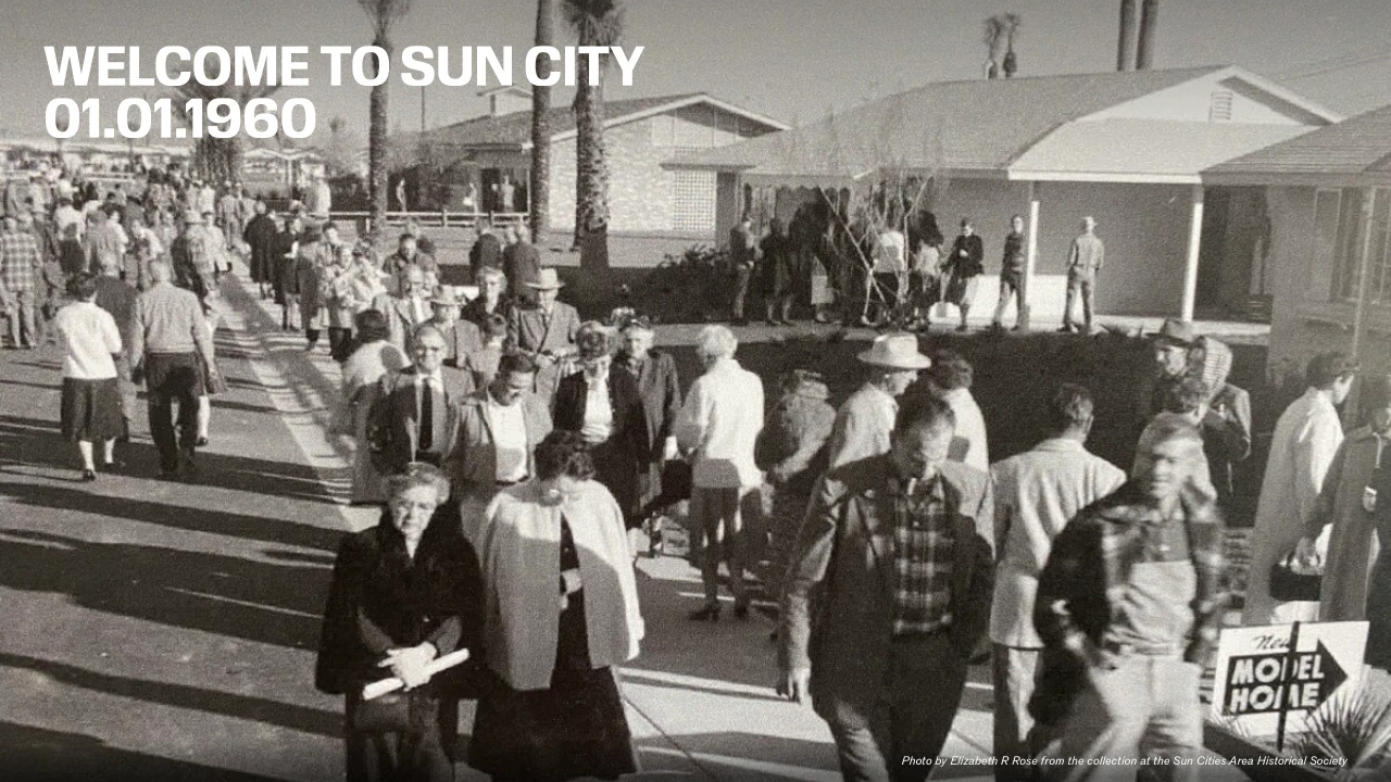
Sun City, Arizona, was a revolutionary new development designed exclusively for active retirees. On the first day, thousands of cars lined up to get in. In the company’s first year, they sold 2,000 homes.
Once the Sun City experiment proved to be a success, towns throughout the Valley put out national advertisements, relaying the benefits of moving to Arizona: a sunbathed city with lots of space and amenities like a pool, carport, and yard. It was the selling of Phoenix as a Western Utopia, where the ideal lifestyle was affordable and accessible to anyone who desired.

So how did the city attempt to achieve a slice of Utopia for everyone desiring it?
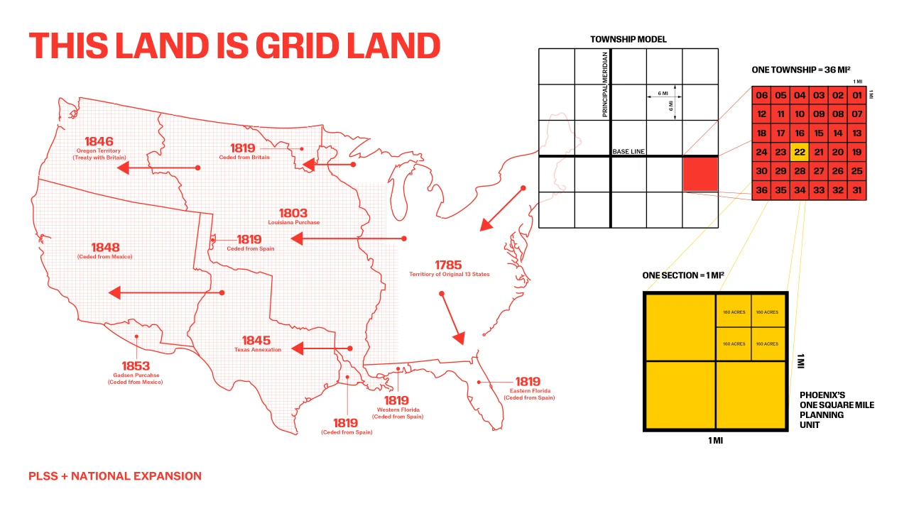
PLSS system known as 1mile x 1-mile, grid system, established in 1785, set the framework on the land for the efficient expansion in all directions.
The grid was an ideological tool to achieve a vision of democratic distribution by breaking land into uniform, legible units. The grid implied fairness, accessibility, and opportunity. This spatial logic aligned with capitalist ideals, transforming land into private equity. The grid becomes a virtual tool to achieve the American Dream.

The Grid as a Tool
[2] Parceling & Complete Neighborhood
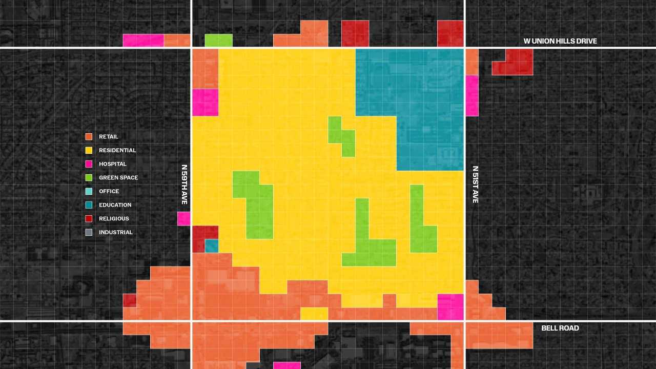
The customized parceling occurred within each one-mile square section to create the complete neighborhood.
Let's take a look at a diagram illustrating a mile section in Phoenix. Everyone has access to essential amenities within a square mile section.
A lifestyle dictated by convenience meets the democratic grid. The grid allows access to everything all the time, and within a certain distance of wherever you are.

The Grid as a Tool
[3] Distribution Choices
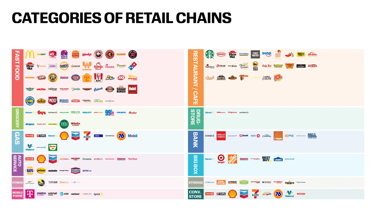
This is a classification of national chain suppliers that we see in Phoenix — the logos begin to define the city streetscape.


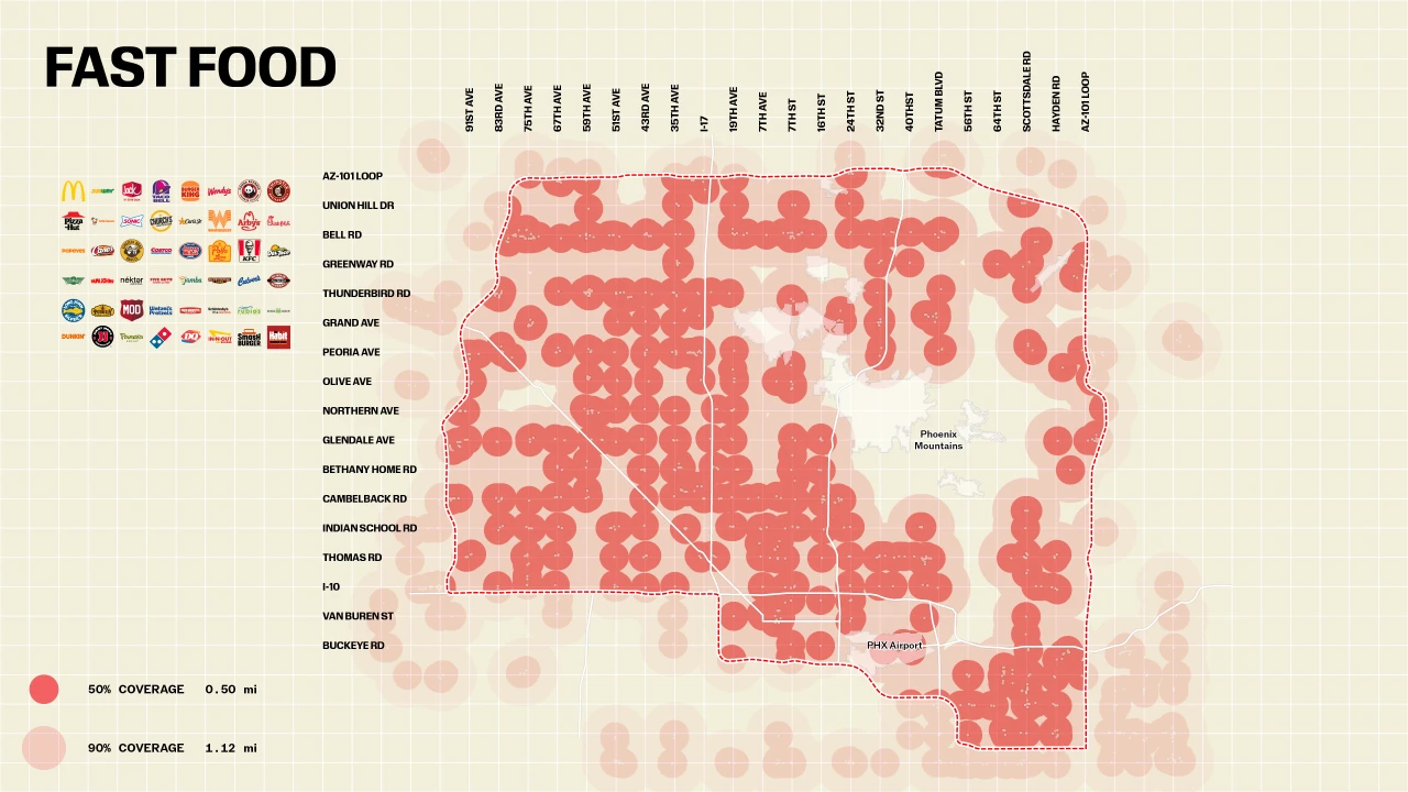
Based on our analysis, 67% of the studied categories cover 90% of the research area within a 2-mile radius, and 100% of the studied categories achieve 90% coverage within a 3-mile radius.

This animation shows what the experience would be of driving down one of the major streets in Phoenix.
These intersections create visual monotony and repetitive streetscapes. The city becomes a blurry scene that has no clear identity and no directional differentiation. It is everywhere and nowhere.
We, as inhabitants of SAME CITY, start to regard the subnormal as normal. Irregularity becomes sporadic. Neighborhoods blur, and the city becomes not a destination, but a system of circulation, meant to be moved through, not remembered. We have gone to the street and collected images of this perceived sameness.
We hope you see it too.
